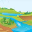
[Free] Basic Hydrology
Creating hydrologic models of small watersheds for conservation bmps, leveraging the power of GIS. – Free Course
What you’ll learn
- Compute peak runoff rates for rural watersheds
- Compute peak runoff rates for urban watersheds
- Delineate watersheds using maps and ground truthing
- Understand the differences between the 3 most widely used hydrology models
Requirements
- Need to be able to download and install NRCS software
- Need to be able to download and install the HydroCAD Sampler
- Have either ArcGIS Desktop Advanced with Spatial Analyst Extension, or the open source QGIS
Description
This course teaches soil and water district technicians and junior engineers how to model small watersheds for conservation and stormwater management structures. Three hydrological models are presented: EFH2, TR-20/TR-55, and the rational method. The course includes a blend of GIS and by-hand analysis methods. For the GIS portions, parallel workflows are presented for ArcGIS (Spatial Analyst extension), and for QGIS. The EFH2 software is presented for rural hydrology while HydroCAD (Free Sampler edition) is used for urban projects. The course culminates in two design examples to allow students to implement what they’ve learned.
Author(s): Tim Clark